Route to a found location
|
Note: To route to a found location, you must have already defined a starting point for the route in one the following ways.
|
- (If you have not done so already) Find the location on the map, as described in Find a location on a map.
-
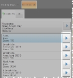
If more than one location appears in the tab listing the found locations, select the location you want to mark as the route's destination location.
The push-pin on the map moves as necessary to identify the location you selected on the tab.

-
Depending on whether you are viewing the search results in basic or advanced mode, do one of the following.
Note: To display the results list in the tab in either basic or advanced mode, click Switch to Basic or Switch to Advanced. The name of the button changes, depending on which mode you are currently in.
The Routing Maps tab opens, a
Destinationlabel appears on the map at the detector or sensor you selected, the route from the starting point to the location you selected appears on the map as a thick blue line, and each turn is identified by a colored dot. The smaller map in the upper right corner of the interface displays the entire route and, if you are using a GPS device, your current location on the route.If you manually set the starting point, the turn-by-turn directions pane in the lower right corner displays the message
Not Routing From GPS, and only the address of the detector or sensor appears in the pane. If you are using a GPS device, the turn-by-turn directions pane populates with additional information.


